Madaba
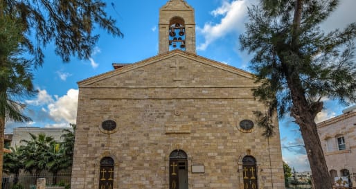
Known as the City of Mosaics, Madaba is most famous for the Church of St George which contains a superb mosaic map of the Holy Land dating from 560AD. There is an interesting visitors' center which explains the map in more detail.

Area
Dead Sea - Jordan Side
Type
Art & Architecture
History
Grade
Standard
Who
Adults
Difficulty
Moderate
Duration
1-2 Hours
The mosaic was discovered in 1885, when a flat area on a hill was chosen as the site for a new church. When the area was cleared for construction, a large mosaic was discovered. The mosaic once covered the floor of an ancient Byzantine church built around 560 AD. The original mosaic was originally an impressive 15.7 x 5.6 m, but the remains are about a quarter of this size. It displays all the major cities and features in the Holy Land with remarkable accuracy. Jerusalem, with all its major features, is the most important city and is placed in the center of the map. The Church of the Holy Sepulchre is clearly shown, as is the Cardo Maximus, a colonnaded main street that ran east-west through the center of the Old City.
There are 157 Greek captions that label most of the important towns and features of the Holy Land at that time. The mosaic also includes the Jordanian towns of Kerak and Madaba.
Recommended Hotels Nearby
A selection of luxury hotel options in the area, handpicked and recommended by our travel specialists.
-
![Exterior - Dana Guest House]() View Accommodation
View AccommodationDana Guesthouse
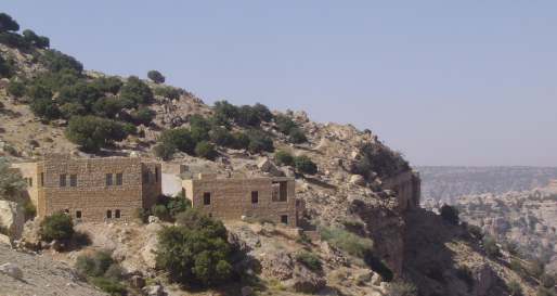
Dana Guesthouse is a simple but charming property, perched on the edge of a cliff overlooking the stunning Dana Nature Reserve in Jordan. The hotel is locally run and provides a convenient base for the night before starting treks into the nature reserve.
-
![Bedroom - Hyatt Zaman]() View Accommodation
View AccommodationHayat Zaman
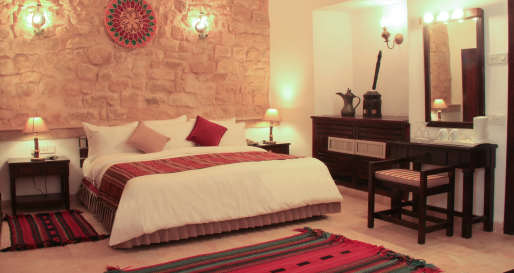
Hayat Zaman (formerly Taybet Zaman) is a charming local hotel situated on a hillside in the village of Taybeh, close to the famous rose-red city of Petra. While it is fairly simple, the Hayat Zaman provides a comfortable base and plenty of character.
-
![Restaurant - Movenpick Resort Petra]() View Accommodation
View AccommodationMovenpick Resort Petra
The Movenpick is ideally located opposite the entrance to the Petra site. The hotel is a mixture of Arabic and international design. There are a number of facilities including a pool and choice of restaurants, providing a comfortable base for exploring.
-
![Library - Fairmont Amman]() View Accommodation
View AccommodationFairmont Amman
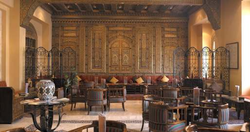
The Fairmont Amman is the most glamorous hotel in Jordan's capital. The property features a range of fantastic facilities, as well as a diverse choice of restaurants. Although fairly corporate, this a great option for those seeking a luxury city hotel.
-
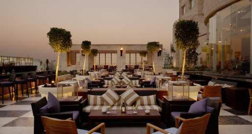
![Outdoor Terrace - Grand Hyatt Amman]() View Accommodation
View AccommodationGrand Hyatt Amman
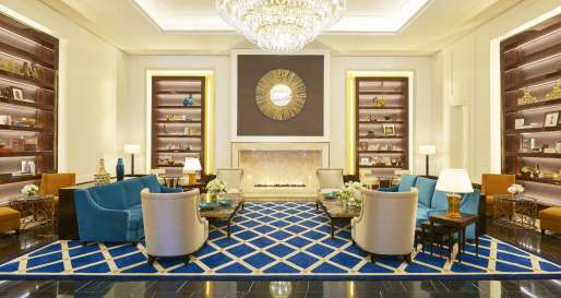
The Grand Hyatt Amman is set in the heart of Jordan's capital city and is a comfortable hotel from which guests can base themselves for local sightseeing, both in Amman and further afield in Jerash. The Grand Hyatt has great facilities and service.
-
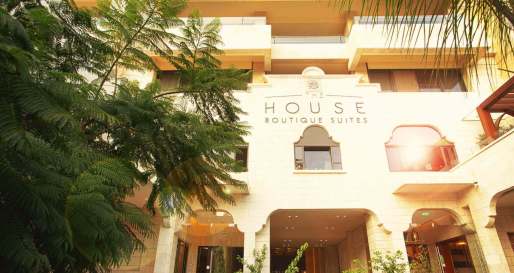
![House Boutique Suites]() View Accommodation
View AccommodationThe House Boutique Suites
For stylish suite accommodation perfectly located for exploring the attractions of Amman and the surrounding area, head to The House, offering tastefully-appointed suites and chic contemporary décor, as well as a smart rooftop pool and terrace.
-
![Executive Suite - Al Qasr Metropole]() View Accommodation
View AccommodationAl Qasr Metropole
Al Qasr Metropole is a small, stylish hotel located in Amman's business district of Shmeisani with extensive views over the city from the upper floors. It has a warm atmosphere as it boasts some of the most popular restaurants in the city.
-
![Deluxe Suite Bedroom - The Four Seasons Amman]() View Accommodation
View AccommodationThe Four Seasons Hotel Amman
The Four Seasons Amman occupies a fantastic location within Jordan's capital. This luxurious city hotel combines smart rooms, excellent service, and a great range of facilities, including a choice of restaurants and a pool, to ensure a comfortable stay.
-
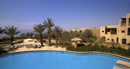
![Hotel Pool - Movenpick Resort and Spa Dead Sea]() View Accommodation
View AccommodationMovenpick Resort and Spa Dead Sea
The Movenpick Dead Sea is located on the northern banks of the Dead Sea and is designed to replicate an Arabic Village, set amid lush green gardens. The resort has an award-winning spa, man-made beach and plenty of dining options.
More Experiences in This Area
Discover more things to do in the area and chat to our specialists about crafting these experiences into your tailor-made holiday.
-
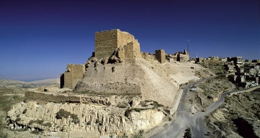
![Castle Exterior 2]() View Experience
View ExperienceKerak Castle
Built in 1161 by the Crusaders, Kerak is a perfect example of medieval castle design. The castle is a dark maze of stone-vaulted halls and passageways. Its most famous occupant was Reynald de Chatillon, who had a reputation for treachery and brutality.
-
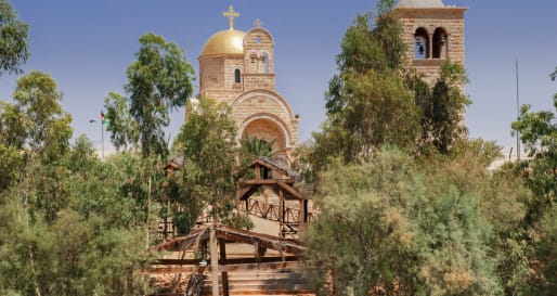
![River Jordan - Bethany Beyond the Jordan]() View Experience
View ExperienceBethany Beyond the Jordan
Visit the site where it is believed John the Baptist performed baptisms in the river Jordan. The site is referenced a number of times in the Bible, most notably as the baptism place of Jesus Christ. A handful of churches have been built in the area.
-
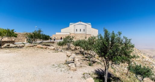
![Church - Mt Nebo]() View Experience
View ExperienceMt Nebo
According to the Bible, in the book of Deuteronomy, Mount Nebo is where the prophet Moses was shown the Promised Land for the Hebrew people. Today, the site contains a church and impressive mosaic collection.
-
![Church of Saint George Madaba]() View Experience
View ExperienceMadaba & Mt. Nebo
Be marveled by the impressive mosaics of St. George Church in Madaba, followed by an excursion to Mount Nebo where Moses once viewed the Holy Land from.
Call us on 212 372 7009 to start planning


